

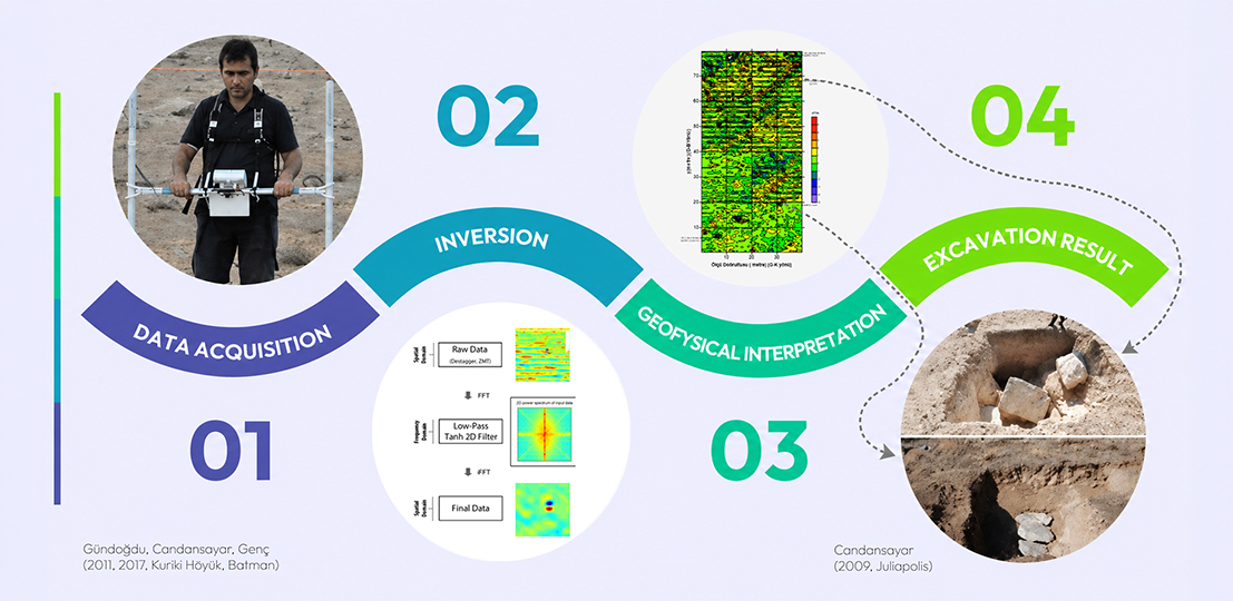
Direct Current (DC) Resistivity or Electrical Resistivity Method
This method is based on examining the resistivity (electrical resistance) properties of structures. While an electric current is injected into the ground via two points, the voltage difference across two other points is measured. This measured voltage difference is multiplied by a geometric factor (k), calculated based on the employed electrode array, and divided by the injected current to obtain the “Apparent Resistivity” data.
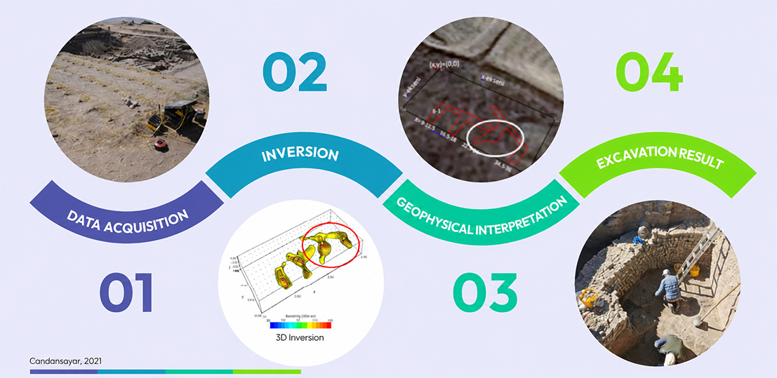
By applying a two-dimensional (2D) inversion to sounding and profiling data collected along a transect, a 2D resistivity model (2D electrical tomography) of the subsurface is created. If sounding and profiling data is collected along parallel lines across an area, all of these data are utilized to perform a three-dimensional (3D) inversion, yielding a 3D resistivity model of the subsurface. This model is also referred to as 3D electrical resistivity tomography (ERT).
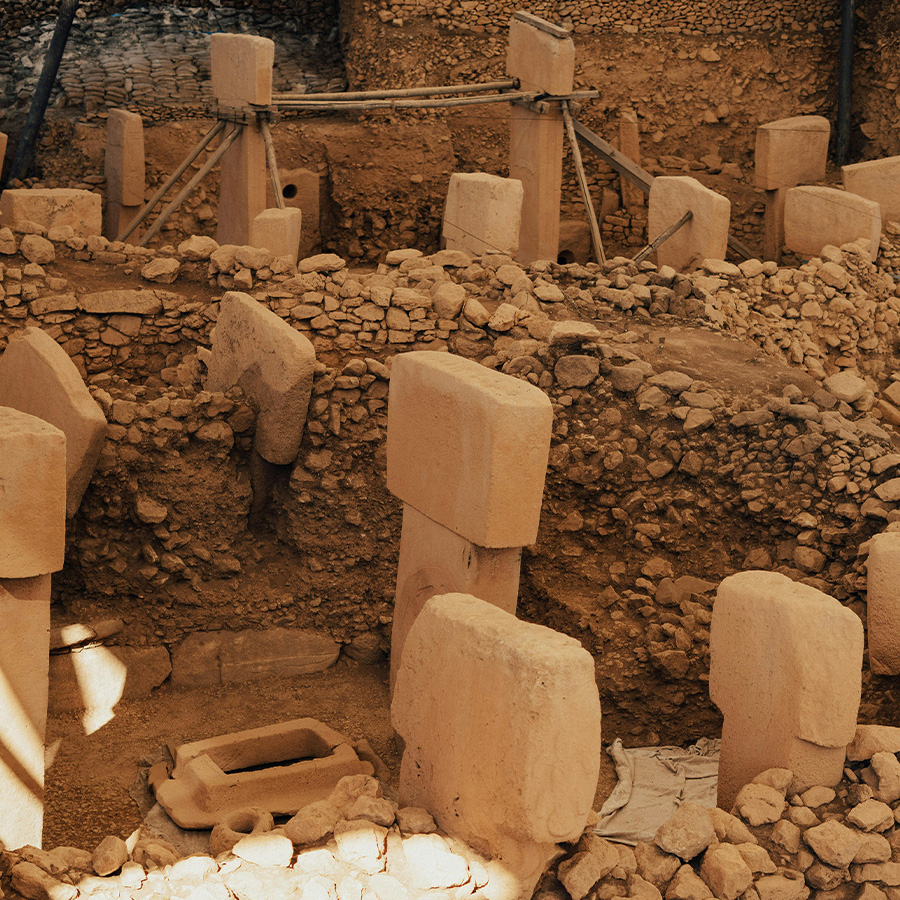
Detectsol acquires data in archaeological sites utilizing multi-electrode and multi-channel resistivity measurement systems. In this way, a “3D resistivity model” (resistivity tomographic image) is generated. The high-resolution data provided by Detectsol clearly presents archaeologists with the depth from the surface and the spatial extension of potential buried structures.
Magnetic Method and Magnetic Gradiometry Measurement
In the magnetic method, investigations are based on the contrasting “magnetic properties” of buried structures relative to their surroundings. This is a natural-source geophysical method. Typically, a magnetometer is used to measure the vertical component of the magnetic field at each station.
Generally, the Earth’s magnetic field undergoes seasonal, diurnal (daily), and momentary variations, independent of the magnetic properties of the surveyed medium. To detect and remove these variations from the measured data, a second magnetometer continuously records at a base station. By measuring the time-dependent magnetic field variations at the base station, corrections are applied to the time-dependent variations at the moving rover station.
In archaeological sites, a much more effective method is conducting Magnetic Gradiometry measurements. In gradiometry measurements, readings are taken at each station using two magnetometers separated by a fixed vertical distance, such as 0.5m or 1m. By taking the difference between the magnetic field values measured by these two magnetometers and dividing it by the distance between them, the “Magnetic Gradient” data is obtained. This automatically eliminates diurnal and momentary magnetic field variations.
Magnetic gradiometry data directly reflects the magnetic properties of the measured point. By applying various “digital filters” (such as average filters, tanh filters, etc.) to this data, the boundaries of buried archaeological structures are resolved more distinctly. In the magnetic gradiometry method, surface metal objects like iron fences, nails, and cars act as noise sources. These metal objects must absolutely be cleared from the site prior to surveying.
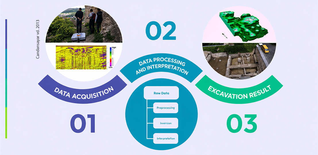 Ground penetrating radar data is acquired along parallel lines to scan the area in 3D. The measured data undergoes fundamental data processing steps (temporal filtering/dewowing, time-zero correction, amplitude gain, inverse envelope gain, band-pass filtering).
The resulting radargram section can then be interpreted. Furthermore, for a detailed interpretation, various migration (F-K, Kirchhoff, etc.) and imaging (full-waveform inversion) techniques must additionally be applied to the data. This method is hindered in highly conductive environments like wet/damp clay, preventing the observation of underlying structures. For this reason, it is not used in such environments. Similar to the magnetic method, surface metal objects and structures cause GPR data to become noisy. These metal objects must be removed from the environment before taking measurements.
Ground penetrating radar data is acquired along parallel lines to scan the area in 3D. The measured data undergoes fundamental data processing steps (temporal filtering/dewowing, time-zero correction, amplitude gain, inverse envelope gain, band-pass filtering).
The resulting radargram section can then be interpreted. Furthermore, for a detailed interpretation, various migration (F-K, Kirchhoff, etc.) and imaging (full-waveform inversion) techniques must additionally be applied to the data. This method is hindered in highly conductive environments like wet/damp clay, preventing the observation of underlying structures. For this reason, it is not used in such environments. Similar to the magnetic method, surface metal objects and structures cause GPR data to become noisy. These metal objects must be removed from the environment before taking measurements. Detectsol’s Archaeogeophysics Experience
Our founder, Prof. Dr. M. Emin Candansayar, has numerous publications on archaeo-geophysics dating back to 1995. Furthermore, he has developed 2D/3D modeling and inversion algorithms for the geophysical methods utilized in archaeo-geophysics. These studies have been published in high-impact international journals. Since 1995, he has conducted “archaeo-geophysics” investigations across various archaeological sites. A list of some of his publications on this subject and the archaeological sites he has investigated is provided at the end of this article.
Additionally, to popularize “Archaeo-geophysics” investigations in our country, he held numerous informational meetings at the Ministry of Culture and Tourism between 1995 and 2000. He has organized workshops titled “Archaeo-Geophysics” and arranged sessions under this topic at various congresses.
Detectsol is the first and only R&D company in Türkiye capable of conducting investigations using the three most effective geophysical methods for archaeo-geophysical surveys (DC Resistivity, Magnetic, GPR). The following state-of-the-art measuring instruments are utilized within our company.
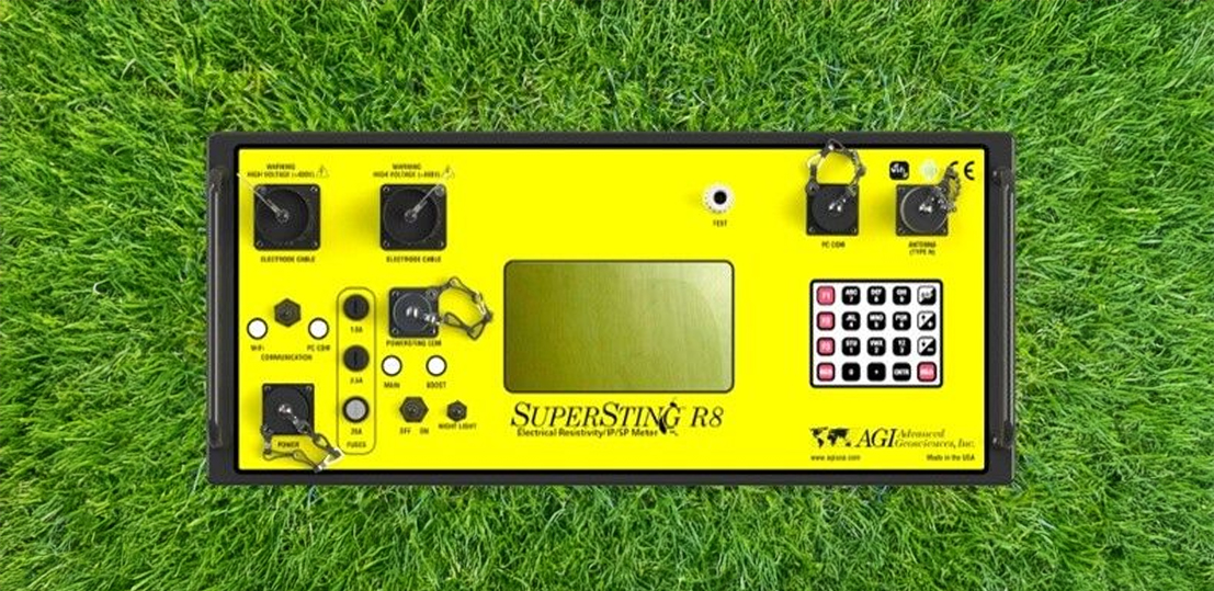
- DC Resistivity Method: Multi-electrode (56 electrodes) and multi-channel AGI SuperSting R8 instrument.
- Ground Penetrating Radar (GPR): Proceq GS-8000 radar system (f-range: 40 – 3440 MHz).
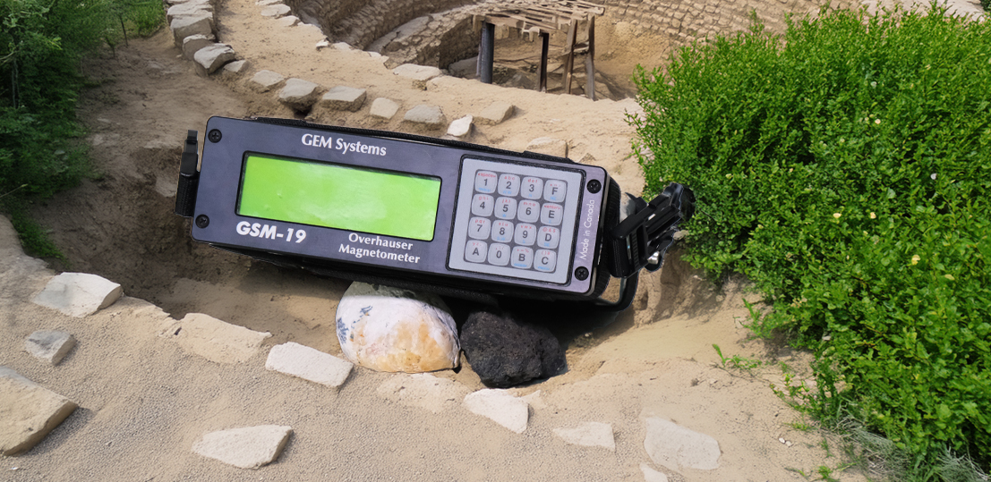
- Magnetic Gradiometry: GEM Systems Overhauser Magnetometer (with 0.022 nT sensitivity).