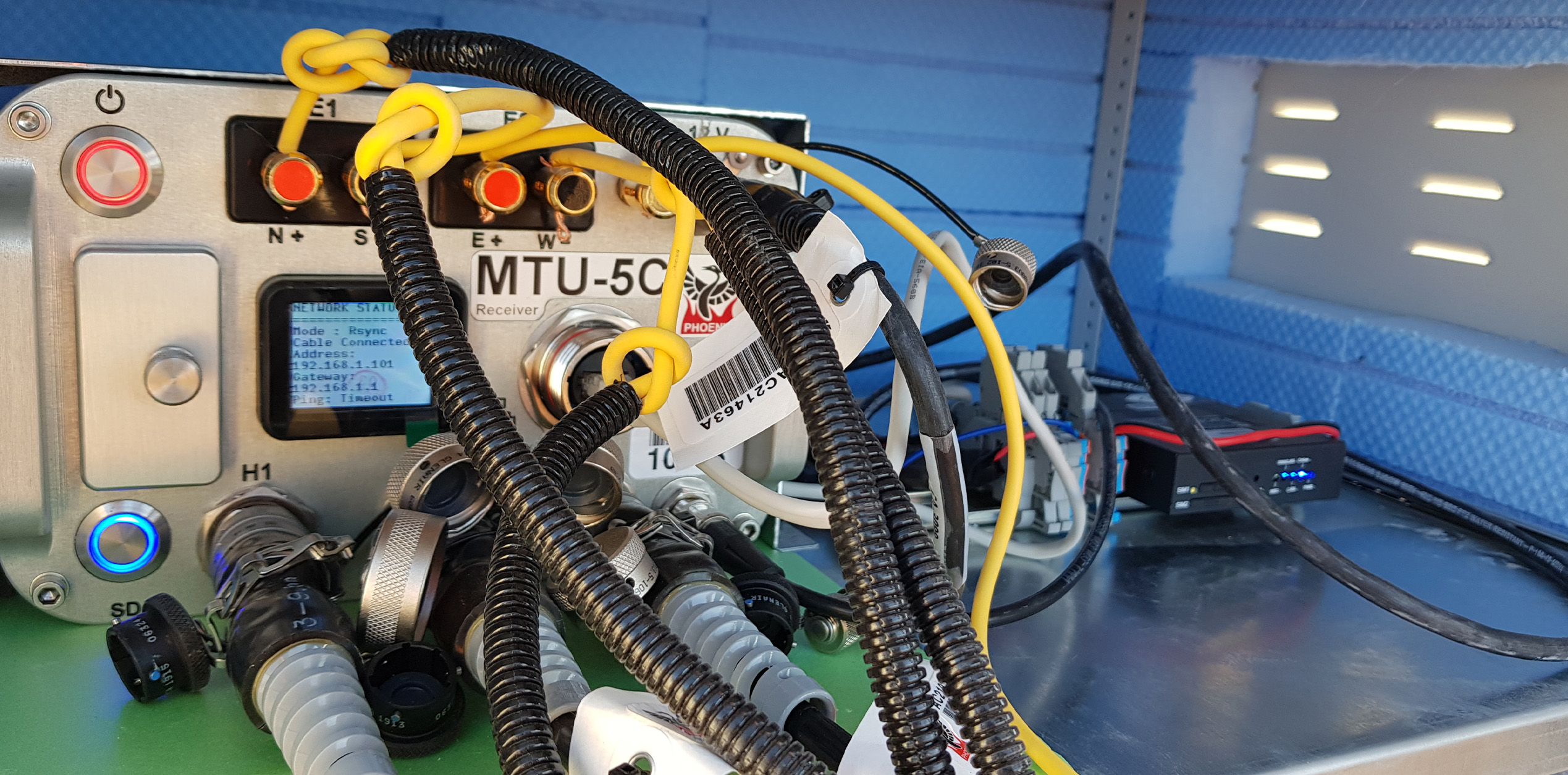
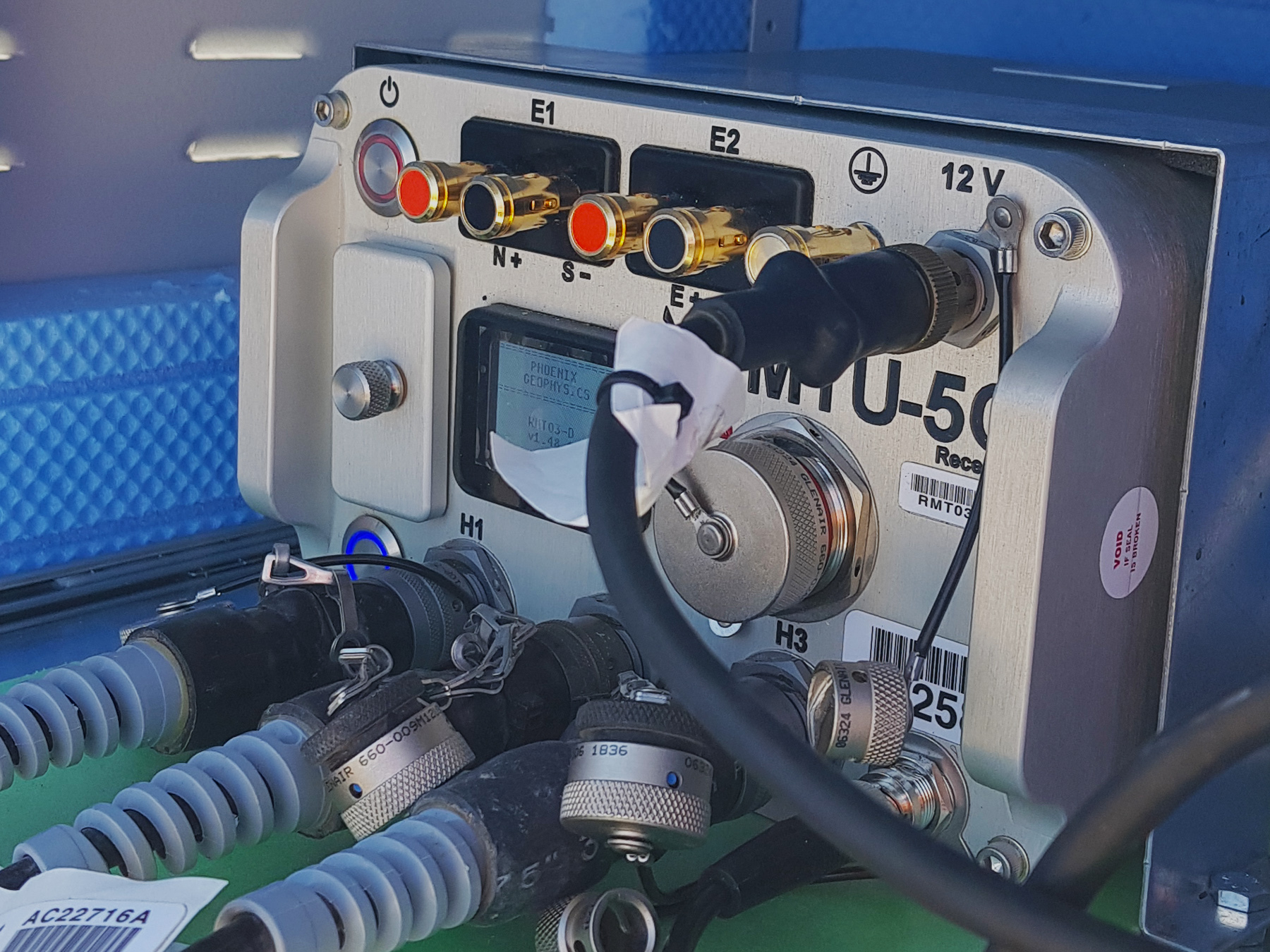
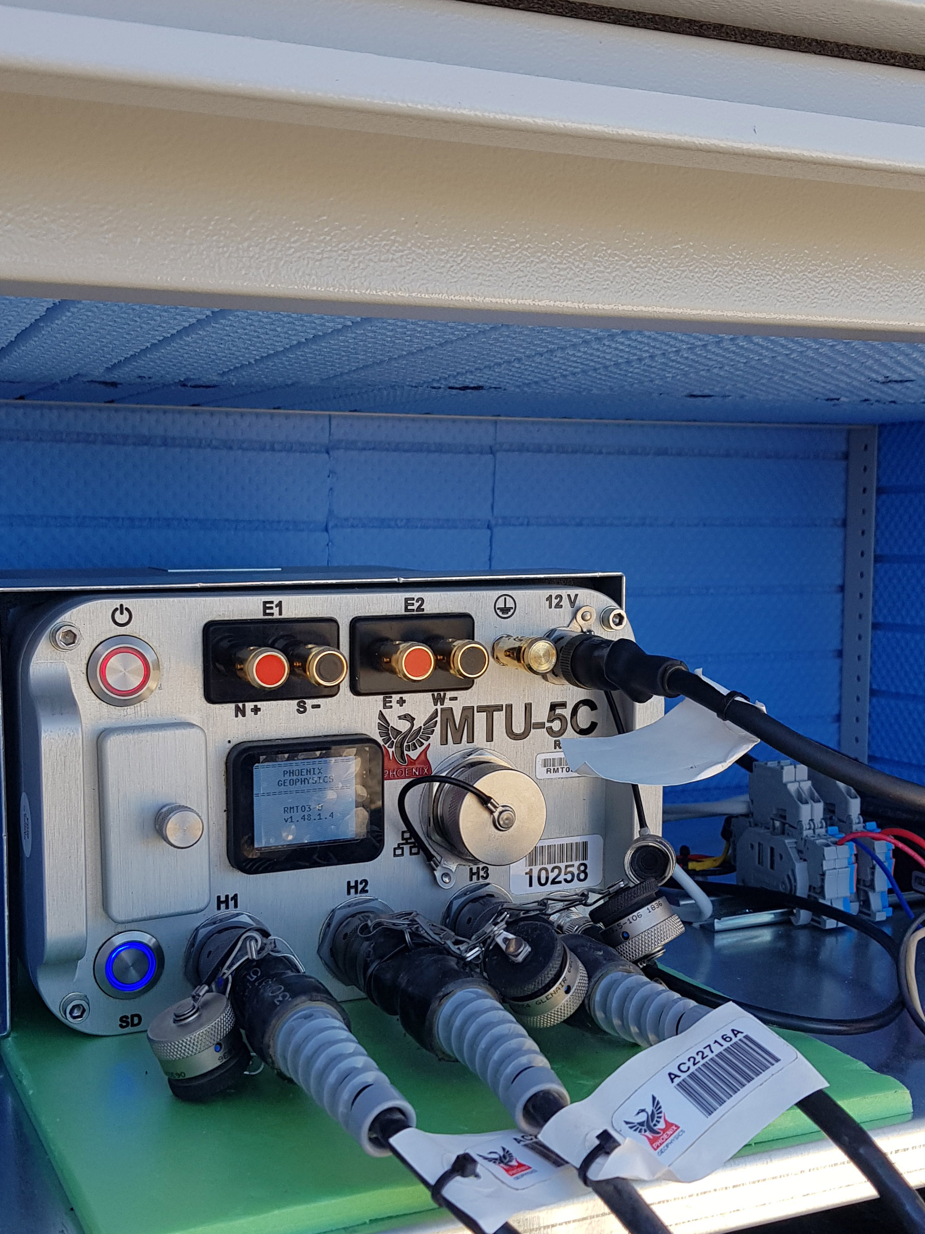
Phoenix MTU-5C Magnetotelluric Data Logger System
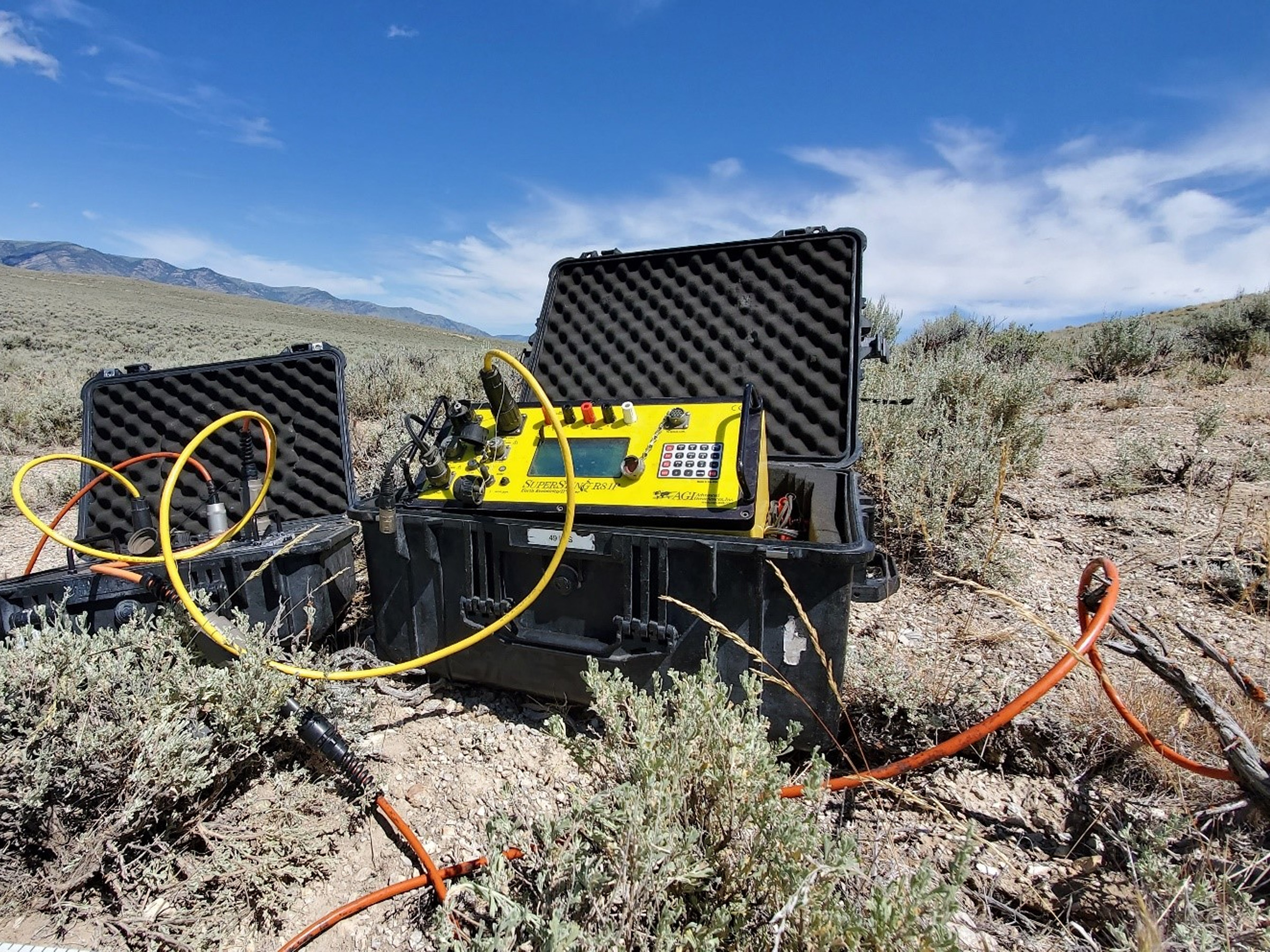
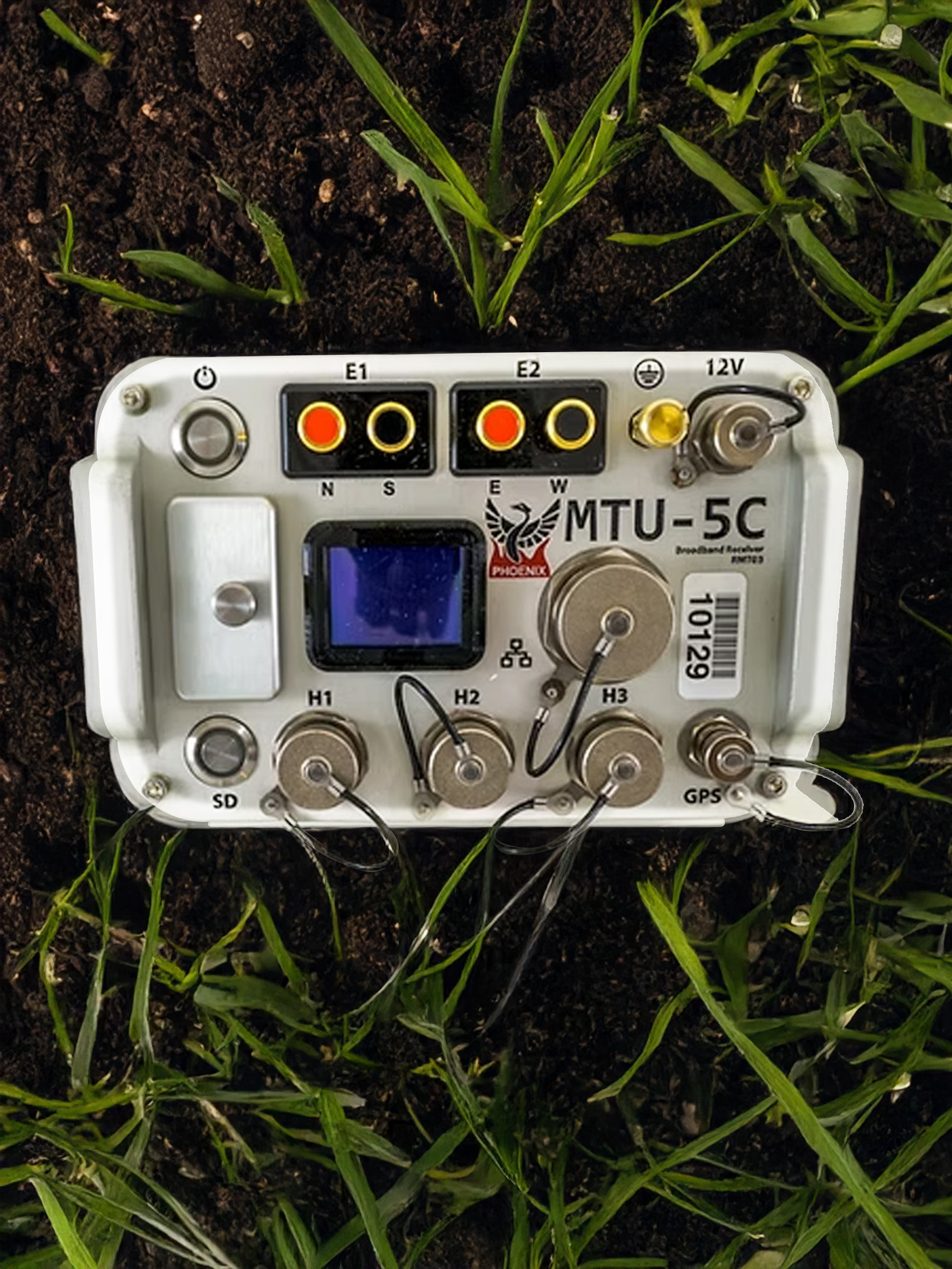
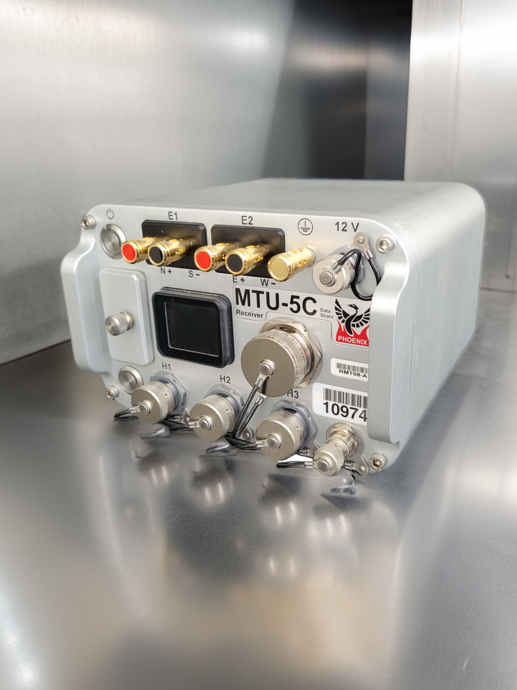
Included in Detectsol’s inventory, the Phoenix Geophysics MTU-5C is an advanced Magnetotelluric (MT) data logger that measures natural electric (E) and magnetic (B) field components. Through this method, subsurface structures are modeled in three dimensions with high precision based on their electrical resistivity parameters, enabling the device to be effectively utilized in geothermal energy exploration, mineral prospecting, hydrocarbon exploration, and deep structural analysis projects.
The MTU-5C offers high efficiency in field operations thanks to its portable design, low power consumption, and synchronized multi-measurement capabilities. The ability to stream measurement data to servers in real-time is a key feature that distinguishes the MTU-5C from its peers; this allows for instant quality control during the data acquisition process, thereby increasing accuracy and managing the field process more efficiently. Furthermore, the ability to terminate the measurement once the targeted maximum period is reached provides significant time savings.
- Digital MT Data Logging
- Low-Noise Receiver Technology
- Time Synchronization (GPS-Supported)
- Rugged and Lightweight Aluminum Casing
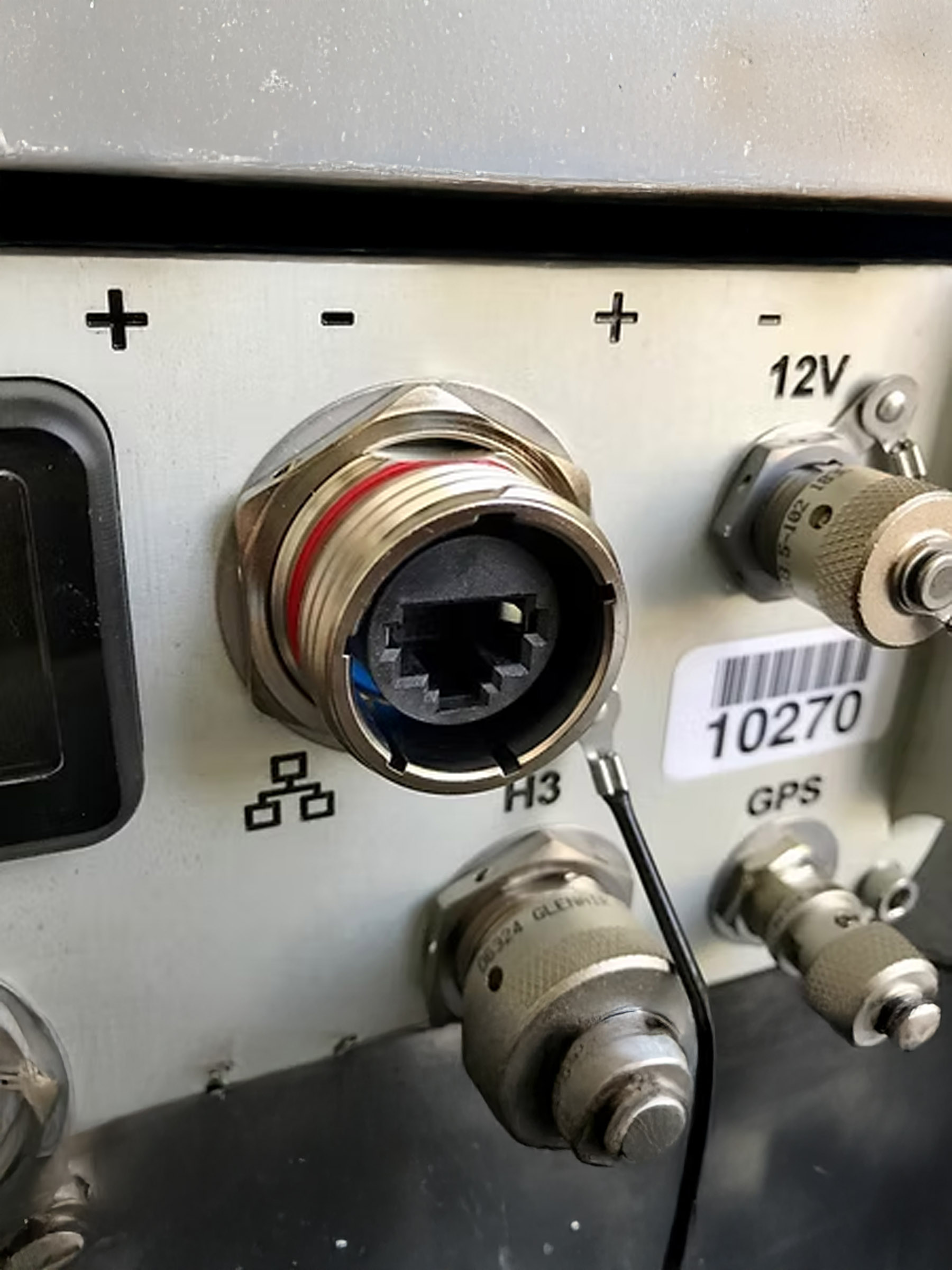
- Multi-Channel Input Support
- Extended In-Field Recording Capacity
Technical Infrastructure of the Phoenix MTU-5C
The MTU-5C was developed to delineate electrical structures extending deep into the Earth’s crust using the magnetotelluric method. By recording variations in natural electromagnetic fields, the device provides frequency-dependent depth sounding. GPS-supported synchronization offers the capability to operate seamlessly with multiple stations. It is optimized for long-term, reliable, and high-resolution data acquisition in the field.
- Streams real-time data to servers.
- Measures 2 electric and 3 magnetic field components simultaneously.
- Generates high-resolution, low-noise digital data.
- Operates with GPS signals for time synchronization; ensuring precise data alignment across stations.
- Provides ample data storage capacity for long-term measurements.
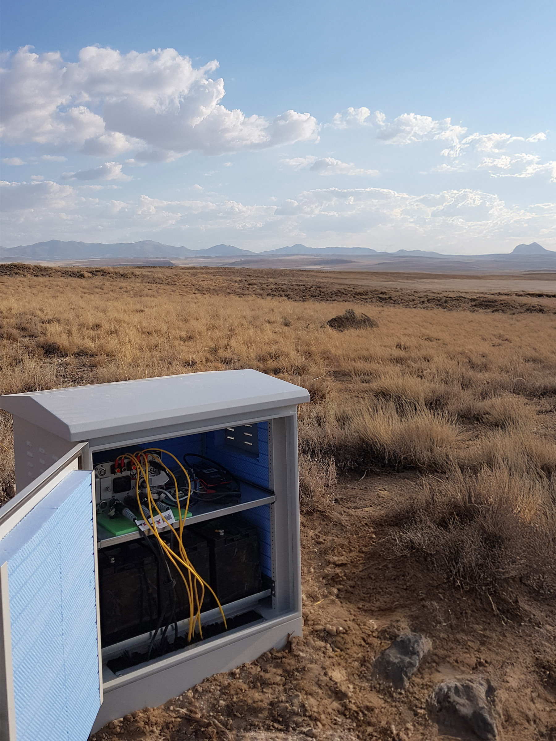
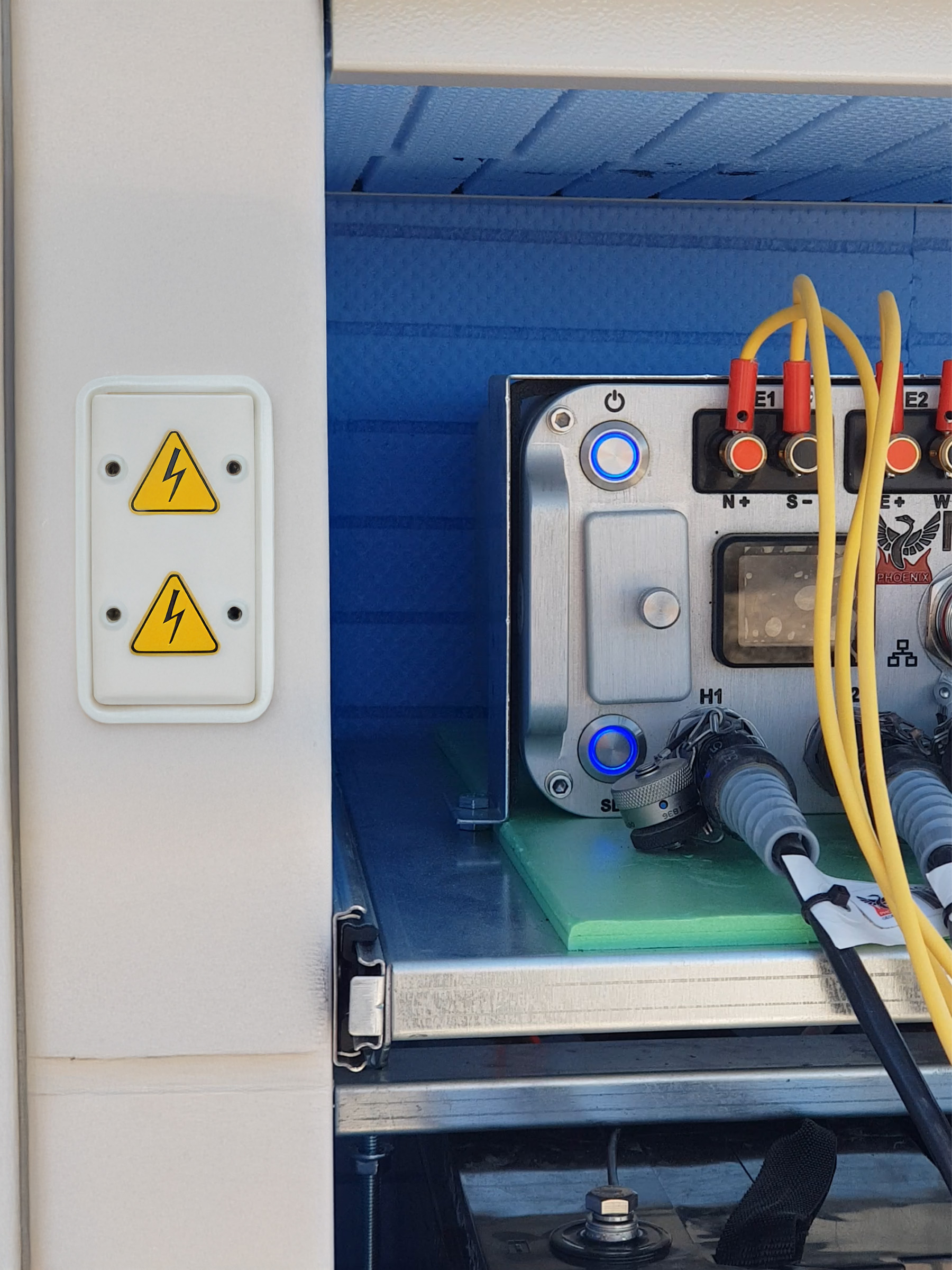
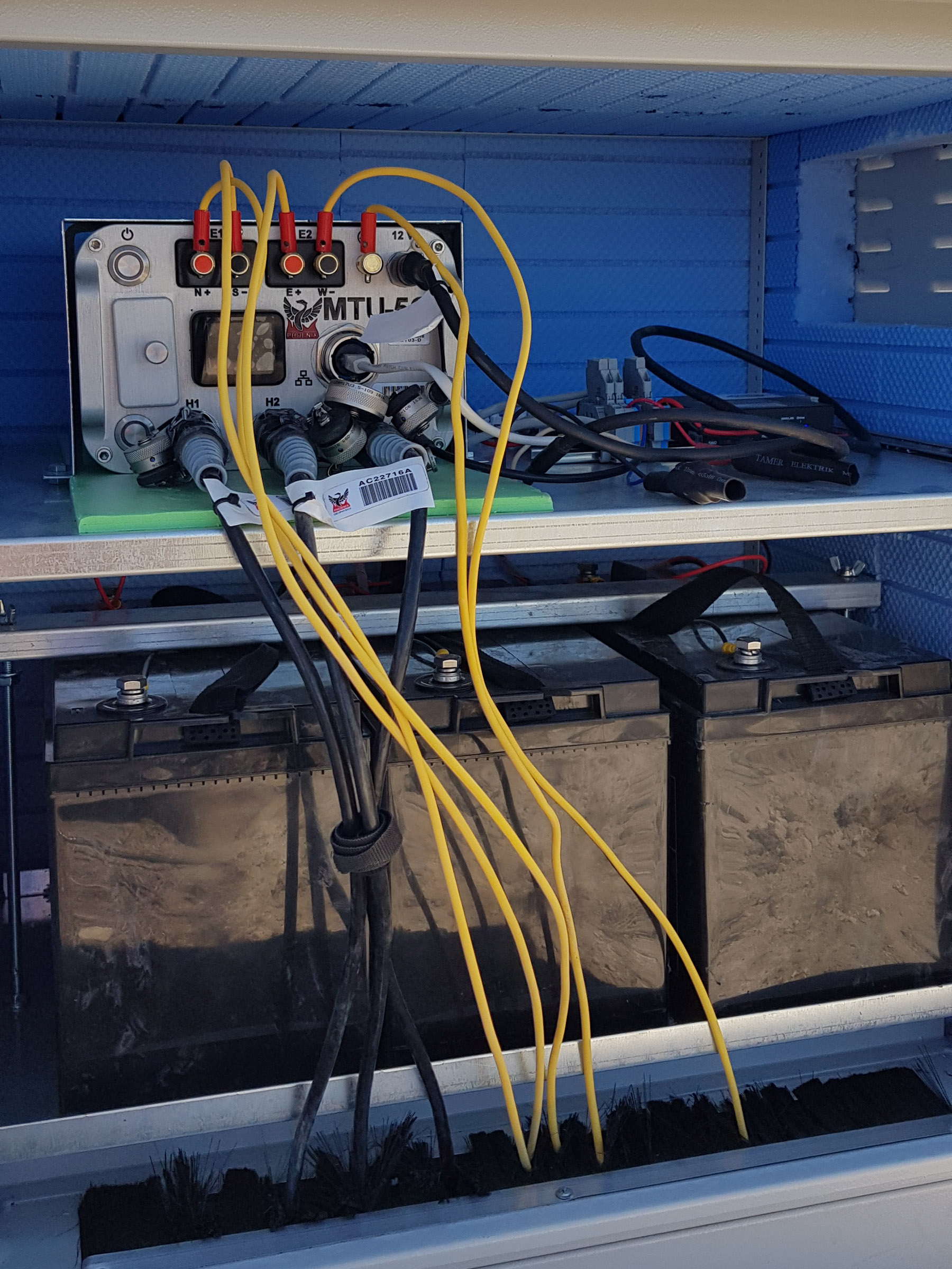
Field Durability and Operational Flexibility
Reliable Measurement in Harsh Conditions The MTU-5C stands out in portable field operations with its lightweight yet robust structure. Its aluminum casing is highly resistant to impact, moisture, and rugged terrain conditions. It is easy to set up and can be comfortably deployed in the field by a single operator. It is the ideal field solution, particularly for long-term MT surveys extending over large areas.
Single-Operator Setup
Ensures practical and rapid operation for field personnel.
Resilience to Climatic Conditions
Delivers reliable performance even under extreme humidity and temperature variations.
Extended Battery Life
Advanced power management enabling uninterrupted data recording.
Real-Time Data Streaming
Data begins streaming to the server in real-time 6 minutes after the measurement starts.
Application Areas
The Phoenix MTU-5C is a professional MT measurement instrument that can be utilized across a very broad spectrum of applications. It plays an active role in various engineering disciplines, from mapping deep geological structures and mineral discoveries to geothermal energy investigations and environmental assessments. It provides a strategic advantage in the field through non-destructive, reliable, and precise data generation.